To counteract this trend, it is crucial to accelerate the process of demolishing the vacant buildings in poor conditions. However, identifying such buildings is an enormous task, that requires man force, inventiveness and a bit of technology. The Blight Removal Task Force was created to provide the City of Detroit with a blight removal system that use all the existing resources in Detroit and suggests new recommendations to set up a scalable, efficient, and environmentally safe strategy. As part of this strategy the Task force teamed up with Data Driven Detroit and Loveland Technologies to create a system to report, store and process the data related to structures in poor conditions.
The team rapidly realized that the city didn’t have a comprehensive database that accurately presented the characteristics of blight in Detroit. As a result the Task force started the Motor City Mapping project, a large effort to collect information about the condition of every property in the city. The process was designed to be repeatable and updatable to ensure that the database will be kept up to date and deliver fresh information for decision-making processes.
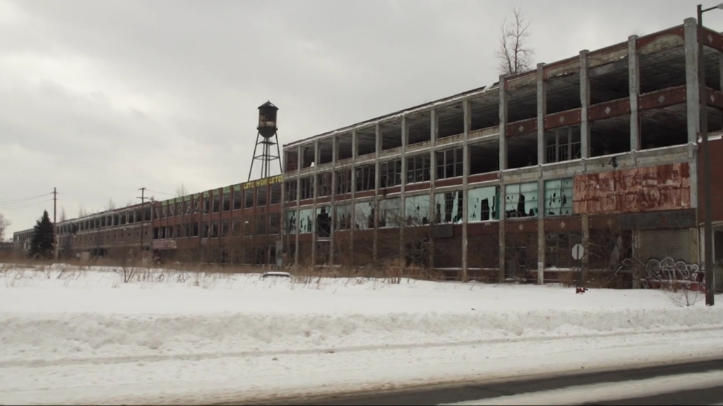
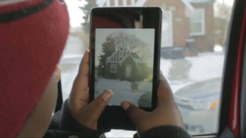
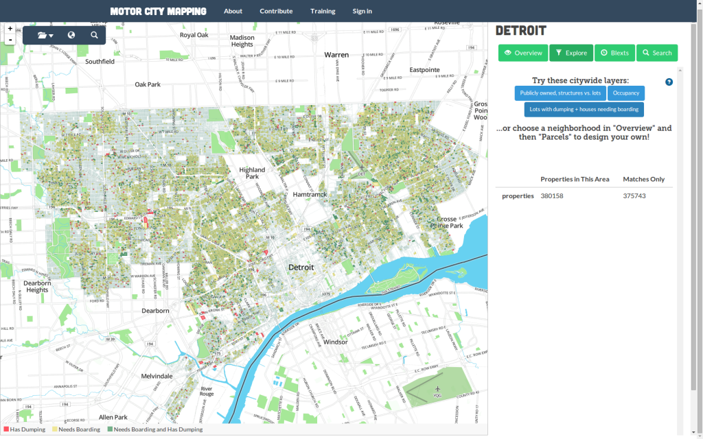
The Motor City Mapping project created both an online map and a mobile application to undertake the colossal, yet crucial task of reporting blight. During a period of ten weeks a team of more that 150 surveyors and volunteers navigated the city streets to document properties in poor conditions. The application allowed the surveyors to take pictures and answer questions related to the characteristics of each property. For example they could provide information about lot vacancy, occupancy, presence of dumping, fire damage, and the actual use of the structures (residential, commercial, etc.)
When the surveyors finished their questionnaire the information was sent automatically to the central database, where the submissions from the field were reviewed by associates. In this way they created a database and an online map, that allow to identify the areas that are more affected by blight. While the tool by itself does not magically solve the blight problem it certainly does deliver the information needed to take decisions that could save entire areas from decay and create lively and strong neighborhoods.
Credits:
Video & Screenshots: Motor City Mapping