 Commonplace is developing a web-based sentiment mapping application that monitors social networks to identify the citizen’s feelings in regard to public transport, road traffic, commuting nodes and other transport infrastructures. It is being developed in collaboration with the Royal College of Art, a leader in the application of design led thinking.
The goals of the project are ambitious. The idea is to combine information of different sources, like weather stations, social media, and official reports to help the passengers plan their journeys in an efficient and stress-free way.
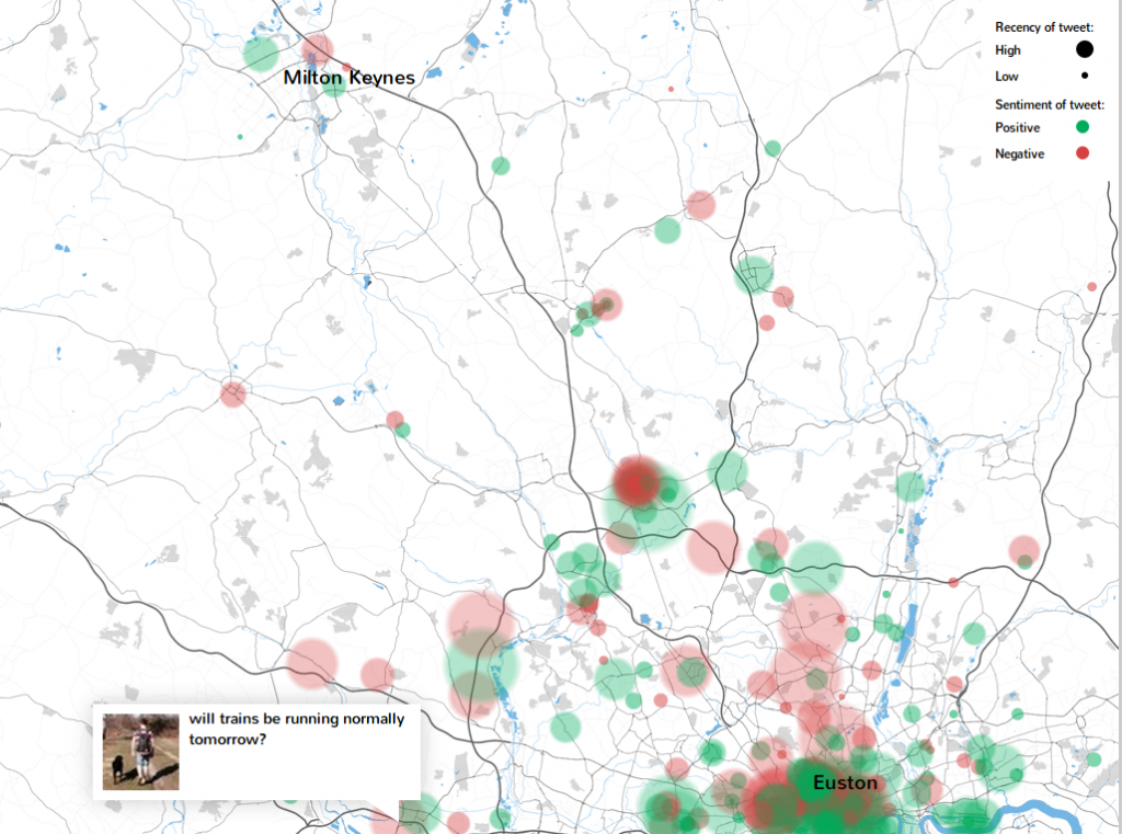
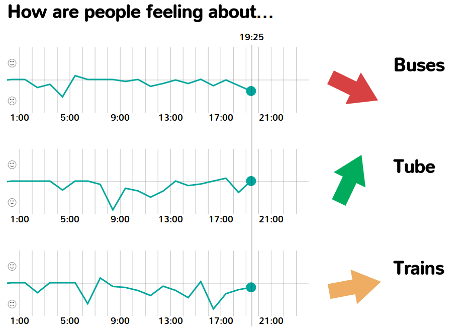
The project is still in a very early phase of development. However, a simple prototype that fetches, stores and displays tweets concerning multiple transport modes is already available. The current version shows an area between London and Milton Keynes, where the passenger’s sentiments are shown in red and green blobs. Another graphic shows the evolution of the mood during the day, including those about trains, buses and tubes.
 According to the developers, sentiment mapping will also provide transport operators a better understanding about the needs of their customers and give them an extra tool to respond to emergencies. The project, however, aims to be more than a mood measuring tool. Sentiment mapping can help to diagnose frustrating issues for the passengers that would be difficult to identify with conventional methods. The information delivered by sentiment mapping can help the responsible authorities to plan or adjust public transport schemes to increase the satisfaction of their customers.
The developers are talking with interested parties to take the project forward. They see in the project opportunities for both authorities and citizens. Through sentiment mapping they can open a simple, yet powerful channel of communication that will help to improve public transport.
Credits:
Screenshots: commonroute.commonplace.is/twitterVisualisation